NASA's ICESat-2 Measurements Reveal More Than First Expected
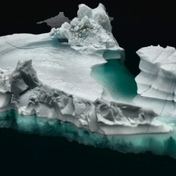
"When ICESat-2 sent back its first measurements on the heights of Earth’s surface in early 2019 the ICESat-2 science team lead, Lori Magruder of the University of Texas, recalls her colleague and fellow science team member Amy Neuenschwander banging on their shared office wall for her to come look at one of the first data sets: A profile of the Mexico coastline showed mountains and trees as expected, but then also continued to the ocean, where both waves at the surface as well as the seafloor below were easily distinguishable. Around the same time, Helen Fricker of Scripps Institution of Oceanography zeroed in on her favorite swath of Antarctic ice – the Amery Ice Shelf – not to look at the height of the frozen ice itself, but to see if meltwater pooling on the surface of the ice shelf was visible from space (it was)."
See the full NASA press release for more information which highlights the work of AOSC's Dr. Sinead Farrell and graduate student Ellen Buckley among others who are studying ICEStat-2 measurements.
- Log in to post comments


